
 Asset Publisher
Polish forests
 fot. Paweł Fabijański
 fot. Paweł Fabijański
 fot. Paweł Fabijański
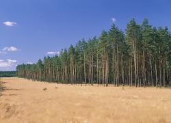
Poland is in the European lead, while concerning the area of all forests. They cover about 29,2 % of the country territory, and grow within the area of 9,1 million hectares. The overwhelming majority of the forests is state owned, of which almost 7,6 million hectares are managed by the State Forests National Forest Holding..
The number of Polish forest is still growing. The forestation rate of the country has increased from 21 % in 1945 to 29,2 % at the moment. Between 1995 and 2008, the forest area increased by 310 thousand ha. The basis for afforestation works is the "National Programme for Increasing the Forest Cover" (KPZL), assuming an increase of the forestation rate up to 30 % by 2020 and up to 33 % by 2050. Polish forests abound in flora, fauna and fungi. 65 % of the total number of animal species live there.
The forests grow in our country on poor soils, mainly because of the development of the agriculture in previous years. It influences the distribution of the types of the forest sites in Poland. Over 55 % of the forest areas is covered with coniferous forests. In other areas, there are forest sites, mainly the mixed ones. Their small part constitute alder and riparian forests – not more than 3 %.
In the years 1945 – 2011 the area of natural deciduous tree stands within the area of the State Forests National Forest Holding increased from 13 to 28,2 %.
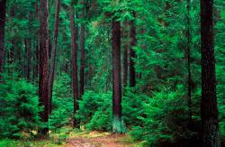
Within the lowlands and uplands the most often occurring tee species is pine. It covers 64,3 % of the forest area of the State Forests National Forest Holding and 57,7 % of private and commune forests. In the mountains the predominant species is European spruce ( in the west) and European spruce with beech (in the east). Domination of pine is the result of carrying on sustainable forest management in the past. Once, the monocultures (crops or cultivations of one species) were the answer to the great demand of industry for wood. Such forests appeared to be quite fragile to climatic factors. They also were often the prey of pests' expansion.
In Polish forests, the share of other tree species, especially deciduous trees have been systematically increasing. The foresters have stepped aside from monocultures – that is why, they try to fit specific species of the forest stand to the natural stand, that would be proper for the given area. Thanks to that, in the years 1945 – 2011, the area of the deciduous tree stands within the lands of the State Forests National Forest Holding increased from 13 to 28,2 %. There occur more and more frequently the following tree species: oaks, ashes, maples, sycamore maples, elms, but also birches, beeches, alders, poplars, hornbeams, aspens, tilias and willows.
Our forests are the most often represented by the forest stands aged 40 to 80 years. The average age of the forest equals 60 years. More and more trees are of big size at the age over 80 years. Since the end of the Second World War, the forests' area has increased up to almost 1,85 million hectares.
Raport o stanie lasów w Polsce 2012

Asset Publisher


Asset Publisher
Obiekty edukacyjne
Obiekty edukacyjne
 Ośrodek Edukacji Przyrodniczo - Leśnej
 Wieża Odyniec na Wzgórzu Joanny
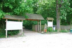 Park w Postolinie (brama wejściowa)
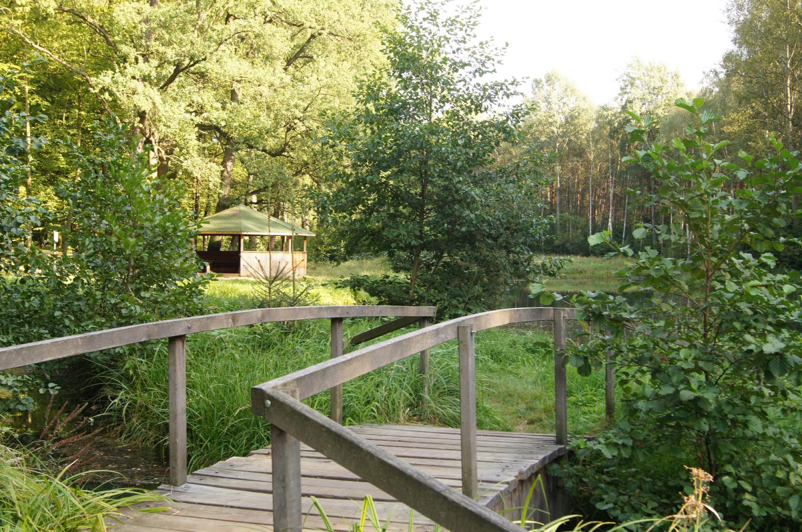
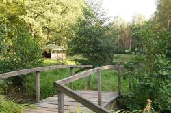 Wiata na ścieżce Karłów-Wałkowa-Karłów
W celu lepszego zapoznania się z lasami i przyrodą nadleśnictwa przygotowano na jego terenie ścieżki przyrodnicze.
Ścieżka Karłów – Wałkowa – Karłów – jest przygotowana dla każdego, kto lubi kontakt z przyrodą. Pozwala zapoznać się z różnorodnymi zbiorowiskami roślinnymi, z gospodarką leśną oraz problemami ochrony środowiska. Ścieżka rozpoczyna się przy Ośrodku Wypoczynku Świątecznego Karłów w Miliczu i tworzy pętlę. Przebiega przez miejscowość Wałkowa, która może być alternatywnym miejscem rozpoczęcia wycieczki. Oznakowana jest w obu kierunkach znakiem ścieżki edukacyjnej (zielony ukośny pasek na białym polu).
Przeczytaj więcej na www.czaswlas.pl/obiekty/karlow-walkowa-karlow-1003
fot. Estera Grocholska
Ścieżka Postolin - Wzgórze Joanny - Postolin – prowadzi przez teren rezerwatu pozwalając zapoznać się z jego walorami. Oznakowana białym kwadratem z zielonym paskiem przekątnym, zawiera 16 przystanków z tablicami objaśniającymi, dostępna jest jedynie pieszo – 8 km. Ścieżka w kształcie pętli prowadzi drogami leśnymi przez najciekawsze fragmenty lasów Nadleśnictwa Milicz. W Postolinie, gdzie ścieżka ma swój początek, znajduje się interesujący park podworski. Kolejne przystanki prowadzą skrajem lasu, za ruinami dawnego młyna wodnego, przy odtworzonym zbiorniku wodnym. Przy przystanku 5 mijamy głaz narzutowy o obwodzie 660 cm, a przy 6 – śródleśną zagrodę w Kozubach. Za nią trasa prowadzi nadal w górę, ale już przez stare lasy bukowe, którymi dochodzimy w końcu do rezerwatu ,,Wzgórze Joanny'' z zameczkiem myśliwskim z 1850 roku na samym szczycie. Po zejściu w dół, opuszczeniu rezerwatu i przekroczeniu szosy na kolejnych odcinkach znajdują się w pobliżu dolinki i inne niewielkie potoki leśne. Na przystankach nr 14 – 16 rosną okazałe, stare dęby, a po wyjściu z lasu, już blisko wsi Postolin, znajduje się stary cmentarz z ciekawymi gatunkami drzew.
Przeczytaj więcej na www.czaswlas.pl/obiekty/postolin-wzgorze-joanny-postolin-1013

fot. Alicja Ostaszewska
Ścieżka Sławoszowice – Ruda Milicka – Godnowa – prowadzi przez fragment lasów nadleśnictwa Milicz a następnie drogą publiczną przez rezerwat ,,Stawy Milickie''. Długość ścieżki wynosi 8,5 km. Rozpoczyna się w Gajówce w Rudzie Milickiej. Zlokalizowana jest tam również chata umożliwiająca zorganizowanie zajęć edukacyjnych. Z Rudy Milickiej trasa prowadzi asfaltową drogą w kierunku północnym aż do Nowego Grodziska, gdzie za budynkiem szkoły skręca na zachód, po czym okrąża staw Gadzinowy Duży.
Przeczytaj więcej na www.czaswlas.pl/obiekty/?p=4&id_obiekt=2863

fot. Estera Grocholska